Description
Pacific Edge Publishing
60 pp, 8.5″ x 11″, full colour, downloadable pdf
Level: Grades 2-4
Summary
Finally, an atlas especially created for younger students! The production of The Junior Atlas of Canada and the World is a successful culmination of a careful collaboration of elementary teachers determined to provide primary students with a resource that is interesting, clear and easy to use. This colourful atlas provides children with simplified political and physical maps of the world, the continents, Canada and the provinces. Unlike most school atlases, the clutter has been kept to a minimum – only the most basic of facts and visual information is given so as not to distract young eyes and minds.
Simple and clear, The Junior Atlas of Canada and the World will be helpful for teaching younger students about basic map skills and for discovering interesting facts about the world and Canada. The colourful and clearly designed maps, fact pages and a simple index of the continents, oceans and countries make discovering our world and country much easier for primary students.
Click here for our Junior Atlas Free Sampler
Comment
“This is a colourful, attractive and basic atlas especially suited to primary students. Students are introduced to basic map depictions of the world, the continents and especially Canada – provinces and territories. The maps depict both political divisions and physical aspects of the continents and Canada. There is a good index and two pages of basic facts on Canada and the world.“
” . . . attractive and basic atlas depicting political and physical diversity of Canada and the world. Easy to read and colourful.“
“Especially notable is the simple, uncluttered easy to read presentation.“ ~BC Ministry of Education
What’s Inside
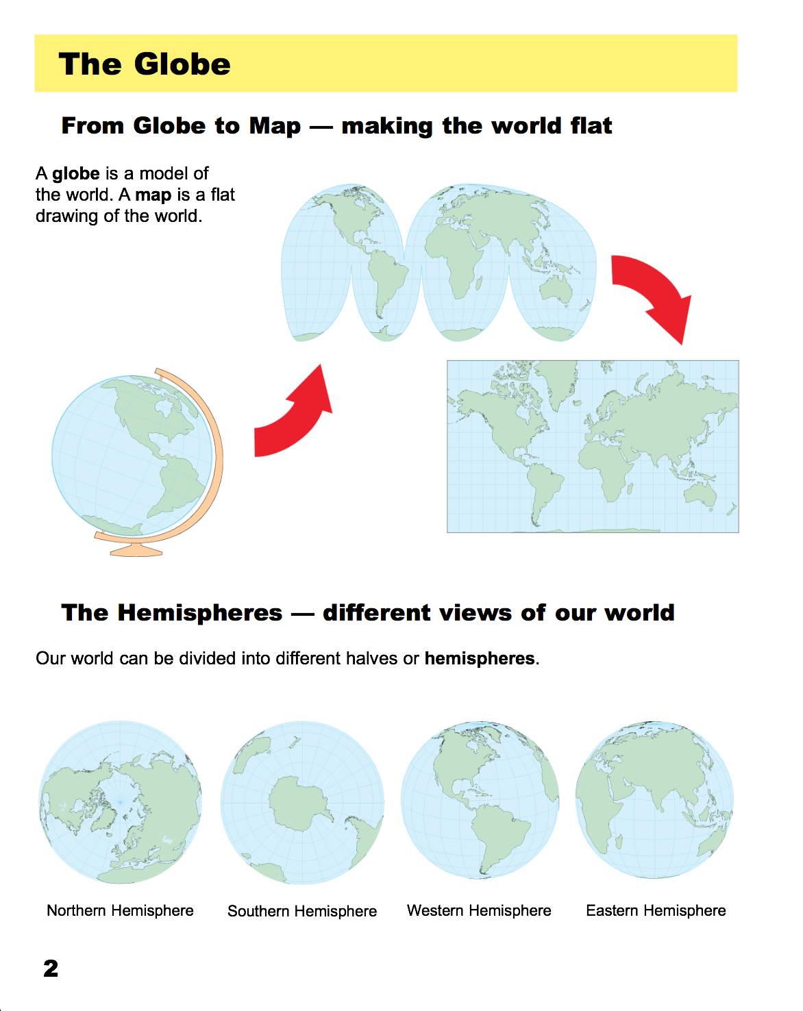
– basic information to help young students understand maps and globes
– simplified world maps showing the continents & oceans (political and physical) and population
– simplified maps for each continent (political and physical) and “fast facts”
– simplified maps of Canada (political and physical)
-a simplified political map for each province and territory showing natural resources and a basic information page with colour photographs
– simplified illustration of the Great Lakes & Waterways.
– a Canada facts page
– a World facts page
– an Index